Turkey Burner - Riverside Remote

Our “Day-After-Thanksgiving” ride to burn off our Thursday feasting!
Join us on this year’s “Turkey Burner” adventure from Riverside downstream via Corona to Anaheim Canyon & train return back up to Riverside.

Everyone, including MEMBERS - please sign up so we know who is coming !

MetroLink Train IEOC 1858 leaves
Anaheim Canyon @ 3:54 pm
($9.50 / $4.75 Seniors)
Corona West @ 4:14 pm
($7 / $3.50 Seniors)
Arrives @ 4:39 pm
back to Riverside - Downtown
You can buy your ticket at the station before you board or on the DAY OF
on the MetroLink Mobile App
Bill, Tara, Sue, Mike, John & Alison, Chris & Ashley, Maya, Lois & Winston are going!
〰️
Bill, Tara, Sue, Mike, John & Alison, Chris & Ashley, Maya, Lois & Winston are going! 〰️
DRIVE to Riverside Downtown Station & saddle up at 10am
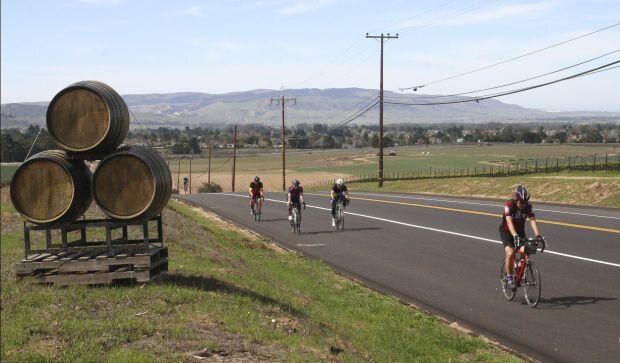
We will ride past the famous Mission Inn, briefly view the mysterious old Inn with it’s holiday decorations a bit, then roll over to Tio’s Tacos for breakfast.
Then we’ll take a leisurely 40 mile ride to Anaheim Canyon by 3:45 ( or 22.5 miles to Corona West by 4:14 to catch the 1858 train one-way BACK TO RIVERSIDE. (or ride out-n-back to Riverside with no train on your own schedule) We will end by 4:30 back at the MetroLink parking lot.
Those interested, will gather for dinner somewhere, and after sunset at 5:30 - stroll downtown to see the annual Mission Inn's Festival of Lights, before heading back home.
Ride Start: Riverside - Downtown Station Park at the train station and we will roll at 10am
Route Slip (10/2/25)
(1 full page - Left half to Corona, Right half continues to Anaheim Canyon)
Option 1: Ride to Corona-West - Train back
At 3pm Evans Brewing Tap Room opens - A great place to cool down, hydrate & wait for the 4:14 train - just 1/2 mile from the station!
22.5 miles +733 ft / -1,023 ft {CF 3 +32.4’/m & DF -4 -45.3’/m}
Map/Elevation - 22.5 miles Riverside to Corona West (Short)

Option 2: Ride to Norco “out & back” - 23 to 29 miles
depending on where you turn back: Follow route slip to mile 12.1 or 14.6 & then turn around & double back the same way to the start…
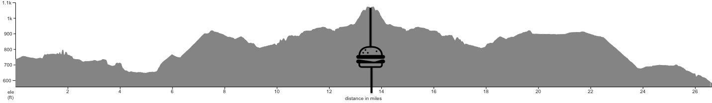
Option 3: Ride to Anaheim Canyon - Train back
39.3 miles +1,118 ft / -1,748 ft {CF 2 +28.4’/m & DF -4 -44.5’/m}
Map/Elevation - 39.3 miles Riverside to Anaheim Canyon
Please share feedback suggestions & comments on this, or any BCI Ride with our Ride Coordinator.
Guests are welcome, but minors (<18) may only ride under the direct supervision of an adult guardian.